Sixty One Degrees
An occassional journal of an Asia-overland adventure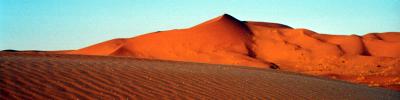
|
|
Kashgar, Xinjiang Province, China
The Karakoram Highway. A name that sets a traveller's heart racing. Running from Kashgar south to Pakistan and beneath some of the world's highest mountains, it's often described as the best overland journey in the world. I'm not going to Pakistan but I thought I'd do at least the start of the trip. As far as Karakol Lake, about half-way to the border.
The journey started simply enough, the city giving way to fields giving way to barren desert. Having started at 9am we stopped in Upal at 10:30am for lunch, this being the last town before Tashkurgen, a further six or seven hours away. I was happy to sit it out on the bus but that was a little too strange for the locals so I got down and joined them in mutton and rice.
From Upal we followed a wide valley, water coursing over the grey rocks. Rising in the distance, beyond barren foothills, the jagged snow-capped peaks of the Pamir Mountains were visible. We climb to a higher valley, green pastures lining the wide valley floor. Gradually the valley narrows and the sides become steeper, the snow-clad mountains looming ever closer.
After some time winding along the ever climbing valley the peak of Mt Konger, 7719m high, looms above. We slide underneath its gaze and confront its companion, 7546m Muztagh Ata. Between them lies Karakol Lake. 3800m high and my destination for today.
I still had a few hours before dusk so I decide to circle the lake, about a three hour journey. On the way I meet a young chap who invites me in to his yurt to meet his family and see their collection of Chiang Kaishek coins for sale. I decline the coins and he then offers a lift on his motorbike, which I also manage to refuse.
The circuit of the lake is sensational. The weather is excellent and both peaks are always visible, high overhead. From this distance though it seems hard to credit their height. It almost seems you could climb them in a day, the height is very deceptive.
I eventually return to my cosy yurt and, just before turning in for the evening I'm greeted by the same young chap. His hands and knees are all bloody and cut up. He's crashed off his bike. He asked if I have any first-aid but I've left it in Kashgar. Just lucky I didn't take him up on his offer of a ride.
The next day I take a guide up to one of the higher pastures beyond the village at the southern end of the lake. About a three hour hike. He tells me that on Sunday the whole village, sheep, yurts, and all, are moving up here for the summer. Would be quite a spectacle. Today the village is a little quiet as quite a few have travelled the 10km by moterbike cross-country to a village in Tajikistan for its weekly market. Border? What border?
On my final day at the lake I decide to head up to the base camp for Muztagh Ata. It lies at 4450m and I find a Swiss climbing team preparing for the ascent. It's going to take the fifteen man team two-and-a-half weeks to get to the top and back. They were preparing the first of three supply drops higher up the mountain as we spoke.
I returned to the lake and headed out to the road to try to catch a lift back to Kashgar, the bus having already gone by. Offers from various hangers-on at the camp were thick on the ground at 150 yuan back to town, complete with dire predictions about the lack of vehicles on the road for hitching. I decide to ignore this and head up to the road, picking up a lift within five minutes for 40 yuan, no haggling required.
As we start off towards Kashgar I cast a glance back south, towards Pakistan and the 8000m mountains of the Karakoram. A trip for another day.
Posted by David at June 15, 2004 10:10 PM